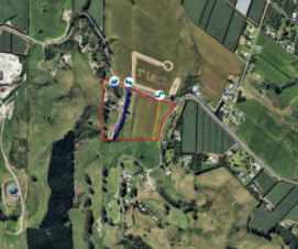
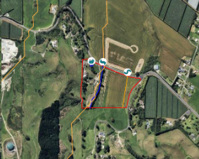
When adding waterways to your farm map it is possible to show an MfE waterway layer over the top of your farm boundary. This may help guide you as you draw in your waterways. Below you can see our imaginary farm, with the second image showing the same farm boundary but with the MfE waterway layer over the top.
Without MfE layer
Showing MfE layer (yellow lines)
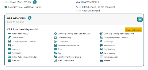
To show the MfE layer simply tick the “SHOW EXTERNAL WATERWAYS LAYER” box.
With the waterways layer showing you can now use the appropriate waterways icon to trace along the MfE layer. Normally this would be the “creek or stream” or ”river icon”.
You’ll see that in our example the MfE layer (squiggly yellow line) doesn’t exactly match the reality on the farm (line drawn in blue) – but it does provide a good starting point for the drawing exercise
As yet we can’t overlay waterway layers from other mapping sources but we are working on adding more (and more accurate layers) in time.